Check out this field test for the Garmin HuntView Maps Review.
Garmin HuntView Features
- Includes BirdsEye Satellite Imagery

- 1:24K Scale Topo Mapping
- Preloaded MicroSD Cards Available
- Land Owner Names with Public/Private Boundaries
- Easy to Use Tracking Features
- Thousands of Roads and Trails with Turn-by-Turn Navigation
- Thousands of Points of Interest
- BLM Information, Plus USGS Quad Locations
- Includes Hunting Map Units
- Compatible with BaseCamp
- Full State Coverage for Maps
This last Fall’s Fishing Trip
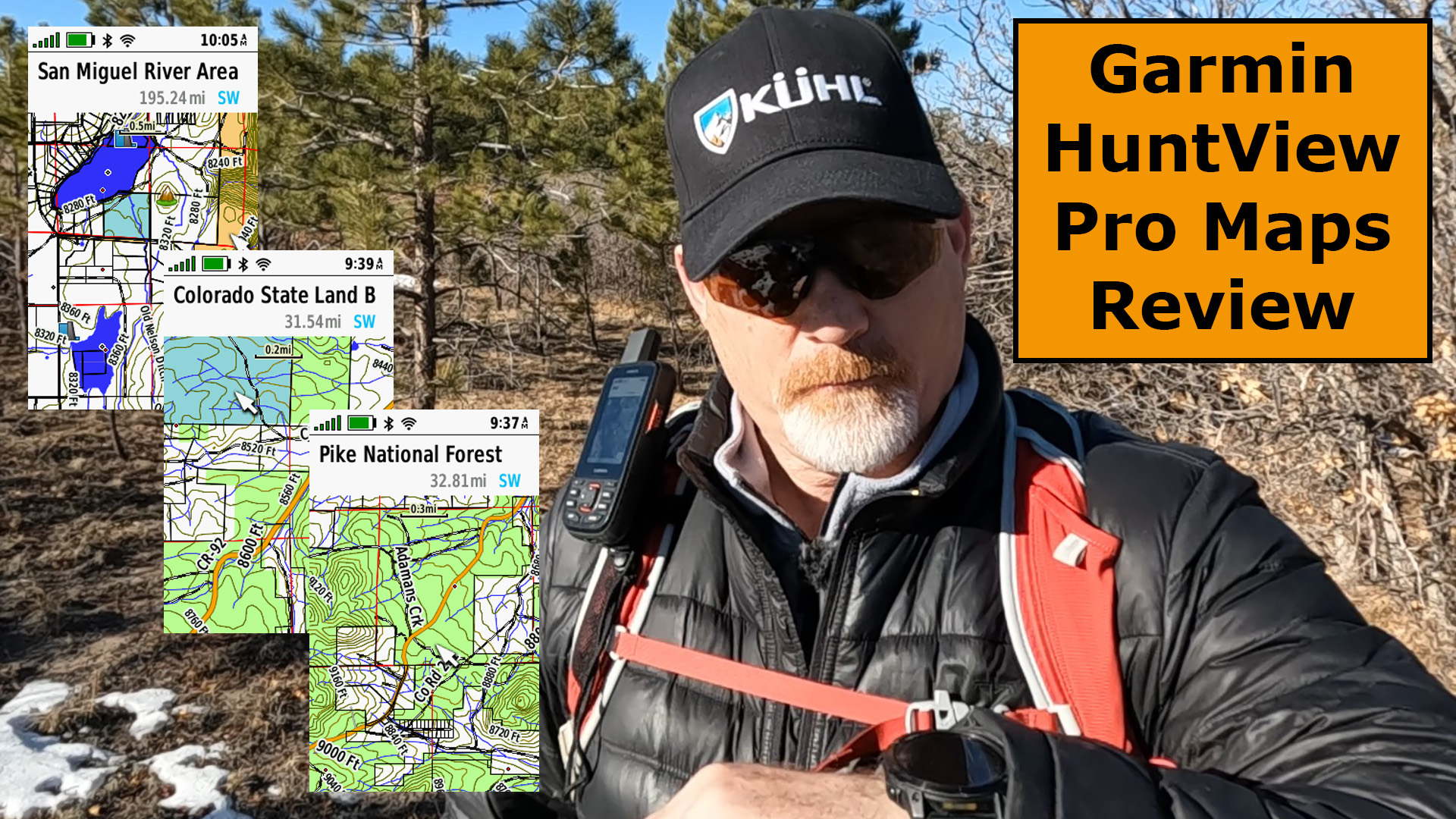
Mike and I had two fishing trips to the Miramonte Reservoir, West of Telluride, Colorado in the summer of 2022 and in November. We noticed there was a lot of private land mixed in with Colorado State land, BLM land and Forest Service land.
It becomes challenging at times to know we were not trespassing on private land. Take a look at some of these Garmin HuntView Pro maps to see the challenges.

It’s great to be able to see the private/public land boundaries, but in addition, the HuntView maps includes the hunting units so hunters will know the area they are allowed to hunt in.
Hiking Trip to Eleven Mile Lake
Last month, we went on a hiking trip to Eleven Mile Lake West of Colorado Springs, Colorado.

On this particular trip, it was confusing as I thought most of the land along the road was private, but there were definitely some National Forest lands mixed in that some people were camping on.
Check out some of these images below.

Final Thoughts
Having the Garmin HuntView Pro maps has made camping much nicer these days, as I know with strong certainty if we are camping on public lands.
Checkout this YouTube video below on the Garmin HuntView field test.

- Easy-to-use mapping solution for hunters and outdoorsmen – plug-in microSD card or download the mapping to a blank microSD card from home
- Identifies landowner names and boundaries for public/private land types and boundaries, using data from multiple sources for superior coverage and detail
- Digital topography equivalent to 1: 24, 000 scale U. S. Geological Survey maps
- Shows thousands of routable roads and trails with turn-by-turn navigation
- Includes searchable points of interest: parks, summits, geographic place names, camping areas, businesses, and more
This product was presentation was made with AAWP plugin.

- Large 3 inch Sunlight-readable color display for easy viewing
- Trigger an interactive SOS to the geos 24/7 search and rescue monitoring center, two-way messaging via the 100% Global Iridium satellite network (satellite subscription required)
- Preloaded Garmin TOPO mapping with direct-to-device Birdseye satellite imagery downloads (no annual subscription), includes multiple global navigation satellite systems (GNSS) support and navigation sensors
- Cellular connectivity lets you access active weather forecasts and geocaching live
- Compatible with the Garmin explore website and app to help you manage waypoints, routes, activities and collections, use tracks and review trip data from the field
- Internal, rechargeable lithium battery provides up to 35 hours of battery life in 10-minute tracking mode and 1-minute tracking mode (display off), 200 hours in Expedition mode with 30-minute tracking
This product was presentation was made with AAWP plugin.
Return to Home Page
Garmin HuntView Pro Maps
Pros
- Public/Private Land Boundaries
- TOPO Maps
- Satellite Imagery
- Hunting Units
- Property Owners
Cons
- Cost